Could a curious geological formation in the Mauritanian part of the Sahara desert anything to do with the lost city of Atlantis?
If you type the word “Atlantis” into Google, around 120 million results will pop up. Obviously, Plato’s legend of Atlantis has long preoccupied many people, from scientists to mysticists, with many candidates being cited as the possible location of this lost and sunken civilization. But did such city ever exist at all? And if yes, where could the ruins be?
The only mention of Atlantis by name in historical texts is in Plato’s Dialogues (written around 360 B.C.), which gives dozens of precise details about what Atlantis looked like, and where it may have been located in relation to other landmarks in the ancient world. It was this level of detail that has set many people off thinking that Atlantis actually existed.
One of the best clues that Plato gives about Atlantis is that there was a series of concentric circles around the city, of black and red stone, and, of course, the inhabitants were a seafaring society:
“Poseidon carved the mountain where his love dwelt into a palace and enclosed it with three circular moats of increasing width, varying from one to three stadia and separated by rings of land proportional in size. The Atlanteans then built bridges northward from the mountain, making a route to the rest of the island. They dug a great canal to the sea, and alongside the bridges carved tunnels into the rings of rock so that ships could pass into the city around the mountain; they carved docks from the rock walls of the moats. Every passage to the city was guarded by gates and towers, and a wall surrounded each ring of the city. The walls were constructed of red, white, and black rock, quarried from the moats, and were covered with brass, tin, and the precious metal orichalcum, respectively.”
So, according to Plato, Atlantis looked something like this:
Image credit: Rocío Espín Piñar
While there is consensus among philologists and classicists regarding the story’s fictional character, there is still much debate as to what could have served as its inspiration. Plato is known to have freely borrowed some of his allegories and metaphors from older traditions, which led a number of scholars to speculate that Atlantis was inspired by Egyptian records of the Thera eruption, the Sea People’s invasion, or the Trojan War. Others, however, insist that Plato created an entirely fictional account, drawing loose inspiration from contemporary events such as the failed Athenian invasion of Sicily in 415–413 BC, or the destruction of Helike in 373 BC.
Nevertheless, there have been countless locations proposed over history for the lost city of Atlantis, including in or near the Mediterranean Sea (Sardinia, Crete, Santorini, Sicily, Cyprus, and Malta have all been considered as possible locations) or in the Atlantic Ocean (the Canary Islands and Madeira Islands are such examples).
More recently, in a viral, and rather convincing (at least for many), video published in September 2018, the YouTube channel Bright Insight claimed that the features of the Richat Structure, otherwise known as the Eye of the Sahara, perfectly match Plato’s description of Atlantis. The video received over 3.8 million views and the story was covered in Germany’s Der Spiegel, Vietnam’s Tien Phong, Business Insider Australia, and the main UK tabloids, among others. Bright Insight claimed that matching features included 5 concentric circles, the diameter (127 stadia or 23.5 km – about 14,5 miles), a waterway outlet to the south, salty groundwater everywhere except below the centerpoint, and mountains with waterfalls to the city’s north. Regarding the structure’s present location – elevated and away from any body of water – the YouTube channel pointed to the fact that lakes and rivers were once present across the Sahara, and that a gradual rise of the land of about 2.5 cm (0.8 inch) per year has since taken place.
The Eye of the Sahara as seen from space. Image credit: ESA_events
Now, could Bright Inside’s claims hold any truth? Well, let’s look at the facts.
We only found out about the mysterious structure when we began sending humans into space. And that’s all we really know about it for sure. Oh, and that scientists don’t fully understand it. Oh, and a few other things:
The Eye of the Sahara, more formally known as the Richat structure, is situated in the western Sahara Desert in Mauritania. On the ground, it’s about 25 miles (40 kilometers) across.
Image credit: NASA/JPL/NIMA
First discovered in the 1930s, the Richat Structure was originally thought to be an impact crater. However, research in the 1950s and 1960s has since eliminated the possibility of it having been made by extraterrestrial impact (a meteor, for example) in favor of terrestrial causes (such as volcanic activity). Eventually, scientists settled for a theory according to which it is a 100-million-year-old dome of molten rock, eroded and shaped by wind and water.
Now, even Bright Insight admits that the Eye of the Sahara is a natural structure, and claims that the Atlantians built their city into the natural formation. This very idea is questioned by Steven Novela on the Neoroligica blog, who rebuts Bright’s Insight’s arguments one by one.
Regarding the YouTube channel’s primary ‘piece of evidence’, according to which the Richat structure is a series of concentric rings that precisely matches Plato’s description of Atlantis, Novela points out that the simple fact that both are concentric rings is not unlikely at all, and since the rings are not discrete and not complete in places, it’s unclear how water would have filled the structure. Also, if you look at the whole formation, you could count four rings of water, instead of the three suggested by Bright Insight. Furthermore, there is no trace of the canal described by Plato, that is supposed to run through all the walls to the inner structure, connecting the rings.
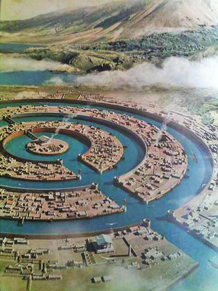
The canal that runs through all the walls to the inner structure and connects the rings, according to Plato. Source
Bright Insight then goes on to argue that the size of the Richat structure matches Plato’s description, which roughly translates to 23,5 kilometers (14,5 miles) in diameter. But then, what do you consider to be the outer edge of the structure? NASA puts the size of the structure at 45 kilometers (28 miles). That’s a considerable difference.
The YouTube channel then points to the surrounding geography, that there were mountains to the north of the city that was otherwise surrounded by flat plains, and opened to the Atlantic ocean to the south. Novela argues that the mountains to the north are hardly an amazing match, and that since the Richat is in the Sahara, there is desert sand where there aren’t mountains, but they are not plains, nor they are surrounded. And as for the opening to the ocean, Novela points out that the sand drift to the southwest Bright Insight refers to is actually more to west than south, as the YouTube channel claims. It also doesn’t open up to the ocean, which is to the west.
Bright Insight also claims that this part of the Sahara was flooded by the Atlantic Ocean 12,000 years ago. That also seems to solve the problem of the Richat Structure not being on an island – well, perhaps it was back then. It did not sink so much as become land-locked.
Well, according to the evidence we have, the Sahara desert is at least several million years old, and there’s absolutely no evidence that western Africa was under water thousands of years ago. So that argument also appears to lack merit.
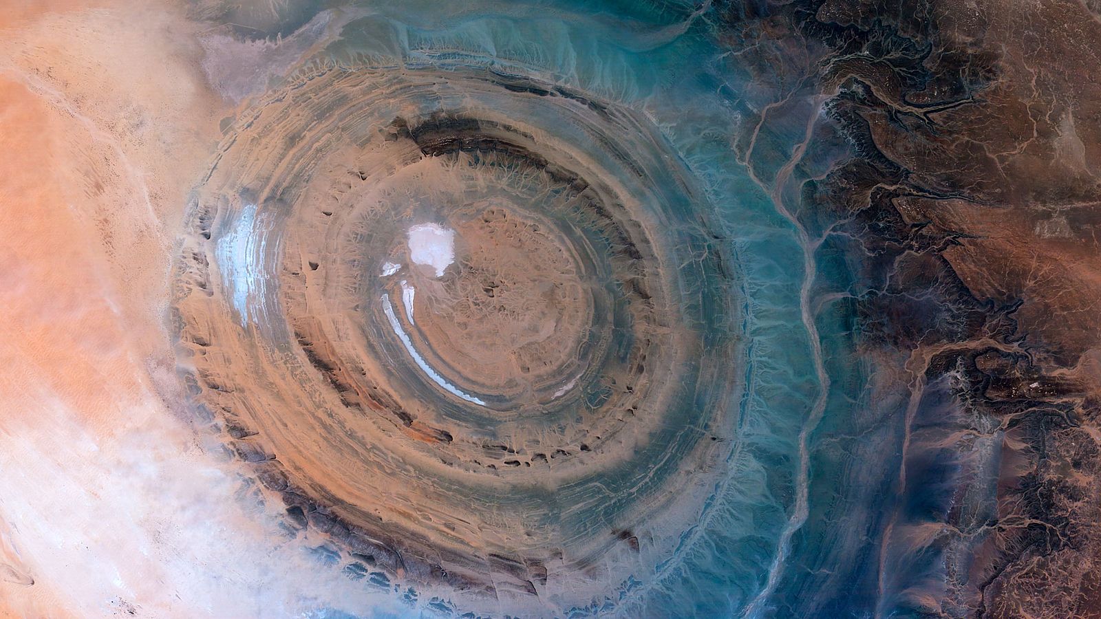
The Eye of the Sahara really looking like an eye. Image credit: Axelspace Corporation
There have been many other ‘parallels’ pointed to by the proponents of the “Eye of the Sahara = Atlantis” theory, some of which appear to be even more far-fetched. Five-time EMMY Award winning writer Paul Wagner, for example, claims nonetheless that King Atlas, aka King of Atlantis, and namer of the Atlantic Ocean is the same person as Atlas of Mauritania; or that Herodotus’s map from 450 BC places Atlantis in the same place as the Eye.
Well, the bad news is that Herodotus did not produce any maps himself. That said, the maps you see circulating on the internet as his are neither real nor a hoax. They were made thousands of years later, based on his work, to help modern readers keep track of all the peoples and geographical features Herodotos mentions. One of these features is Mount Atlas, and one of these peoples is the tribe of the Atlantes (= the people of Mount Atlas). But Herodotos never mentions any place called Atlantis.
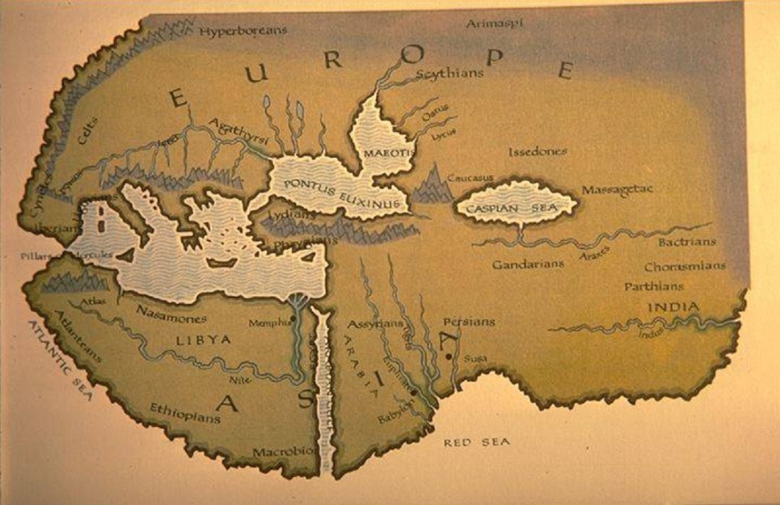
Herodotos’ map in fact wasn’t drawn by Herodotos.
Wagner also puts forward some other interesting claims, including that many elephant bones have been found near the Eye, in line with Plato’s report of an abundance of elephants, and many other animals, on Atlantis (we at Earthly Mission could not find any traces of that evidence online), or that fresh water flowed from the center island of Atlantis, which also exists in the center circle of the Richat Structure (evidence is also hardly available in this regard).
One of Wagner’s seemingly most convincing claims is that there have been thousands of artifacts found in and around the Richat Structure. He suggests that the objects found – including arrowheads, spears, stone spheres, surfboards, oars, ship hulls, and more – are from the time frame of Atlantis.
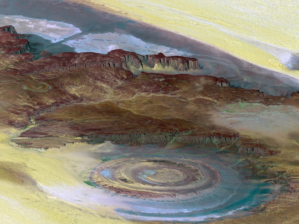
Richat Structure – Sahara Desert, Ouadane, Mauritania. Image credit: Trodel
Well, the Richat Structure is indeed the location of exceptional accumulations of Acheulean artifacts – stone tools characterized by distinctive oval and pear-shaped “hand-axes” associated with Homo erectus, as well as derived species such as Homo heidelbergensis. But Acheulean technologies first developed about 1.76 million years ago, and although their disappearance is not well defined, they could have lasted until about 130,000 years ago (much earlier than the proposed time of Atlantis’ existence about 12,000 years ago). Also, while indeed many of these artifacts have been found on the outermost depression of this structure, they are generally absent in its innermost depressions.
In fact, neither recognizable midden deposits, nor man-made structures have been recognized and reported from the Richat Structure so far. This most probably indicates that the Richat Structure was used for only short-term hunting and stone tool manufacturing, and the apparent wealth of surface artifacts in places is the result of the concentration and mixing by deflation over multiple glacial-interglacial cycles.
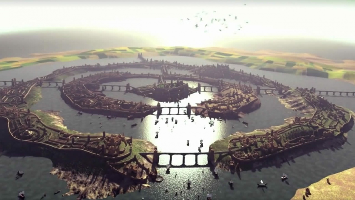
Could the Eye of the Sahara have looked like that? Well, it’s unlikely. Source
Most importantly, there is absolutely no archaeological evidence of a city in the Richat Structure that existed 12,000 years ago, even though Plato wrote about a large, advanced settlement. There are no remains of a city’s worth of artifacts, of the technology, or even a shard of clay pot, something. There is no evidence of engineering, of actual walls or man-built structures, or any improvements to the natural environment.
You simply cannot have a civilization build an entire city and leave nothing behind. So if you ask us, the geological history this formation reveals is way more interesting than the Atlantis theory.

